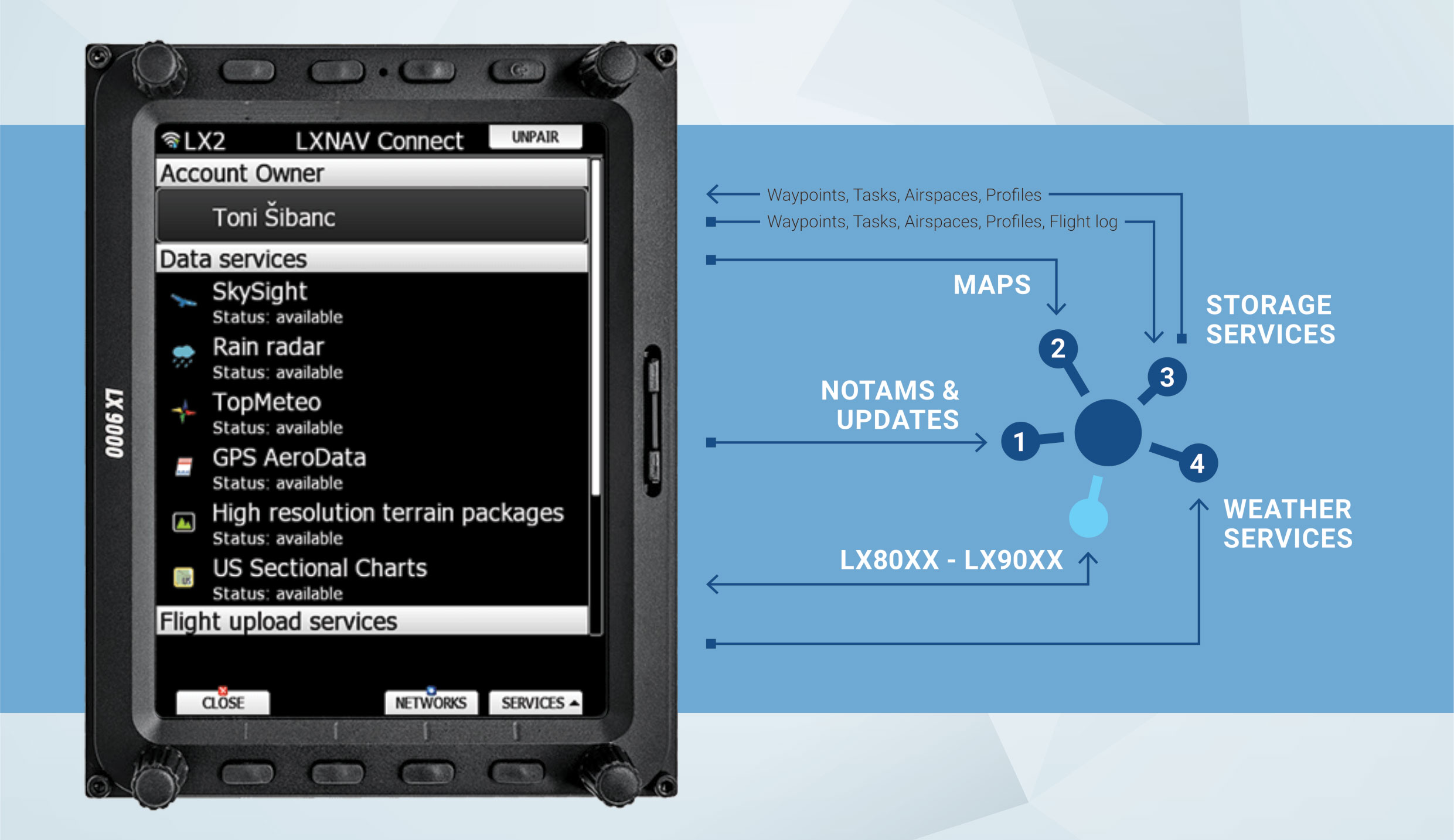
Have you considered connecting your LX80/90xx device to the internet?
It will make your life as a pilot much easier. We have developed web services called LXNAV Connect, which connects your device to various web providers and data sources.
SERVICES
Supported services
WEATHER
- SkySight: numerous prediction layers and live satellite imagery
- TopMeteo: daily potential flight distance, hourly wind, clouds and live satellite imagery
- Live rain radar
|
MAPS
|
FLIGHT UPLOAD
|
FILE STORAGE
|
SYNC AND TASKS
- Automatic task download from SoaringSpot
- File synchronization of profiles, waypoints, airspaces etc. from/to storage.
|
NOTAMS AND UPDATES
|
Some services require an account and/or valid subscription.
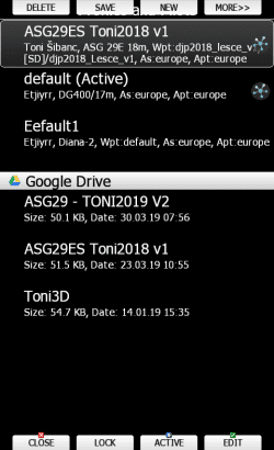
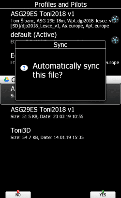
LXSTLYER & PROFILE SYNC
Profile sync
Profile sync allows you to have a single profile synced across various devices via file storage. You can easily edit your profile with LXStyler and save it to your file storage.
When you turn on your LX80/90xx device, it will automatically sync your profile from your file storage of choice. To enable profile sync upload or download the profile to/from your file storage and confirm the “Sync” option.
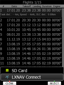
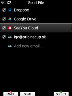
SENDING FLIGHTS
Flight upload
With a single push of the “SEND” button, the selected flight is uploaded to multiple destinations at the same time. The flight is uploaded to LXNAV Connect server and then dispatched to all of the selected service providers. This conserves your data usage and provides reliable delivery to destinations of your choice.
Along with flight, you can also choose to upload the complete logbook.
Unfortunately, because of the restrictions imposed by the OLC team, we are no longer able to support direct claim functionality. Should these restrictions ever be lifted, we would be happy to resume the OLC upload & claim service.
For details on how to claim the flight to OLC, please contact the OLC team at [email protected].
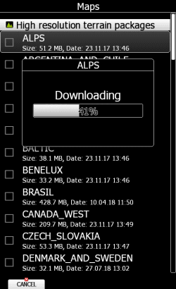
DOWNLOADING MAPS AND CHARTS
Maps
US sectional charts and High-resolution terrain files are available for free via LXNAV Connect map service. Maps are downloaded via the internet directly to your device. No more forgotten SD cards or USB keys! Download the data you need ad hoc.
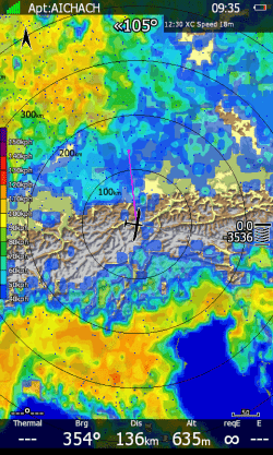
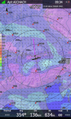
SKYSIGHT, TOPMETEO, RAIN RADAR
Weather services
We support various weather services. On the device, you can overlay up to 3 layer types: satellite, prediction and rain. For satellite and rain (live layers) you can define the animation length (from past to present time) via “History span” setting. For prediction layers you can define a time offset from the current time (this setting is named “Forecast time”).
Tip: To use multiple layers, you can duplicate pages on your device, go to map options, set the options per page and then select the layer of your choice for the page.
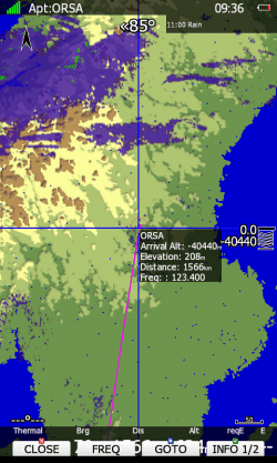
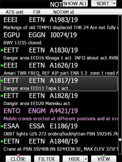
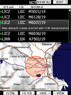
VIEWING NOTAMS
NOTAMs
GPS AeroData is a database service by PocketFMS that provides an up to date database compiled of airspaces, NOTAMs and customized information.
|