Version 2.21
Get connected!
Version 2.21 is fully dedicated to LXNAV Connect – Cloud services. Another important feature is supporting Map/Terrain for detailed navigation. You can download them for FREE. There are also some user friendly improvements (graphics, user interface) and minor bug fixes. Upgrade it for Free.
Maps and Terrain
Maps and Terrain are now available. There are many elements so you will know your flight surrounding even better. Elements like: water, road, highway, street, town, track, airport, power lines, rail etc. Updates are completely FREE of charge.

Let’s connect!
-
Download .cup or .cub files from services like Dropbox / SeeYou Cloud / Google drive
-
Send flights to your email
-
Upload flights to SeeYou Cloud
-
Upload flights directly to OLC
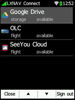
Cloud services
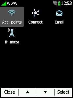
Internet options
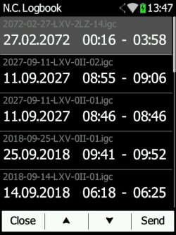
Send flights from the Logbook
Various Improvements
-
Major Graphic improvements (Top row, icons, symbols…)
-
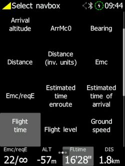
Added navbox row slider (now you can have 12 navboxes for each page)
-
Added many new polars and navboxes
-
Added Landing Gear Warning
-
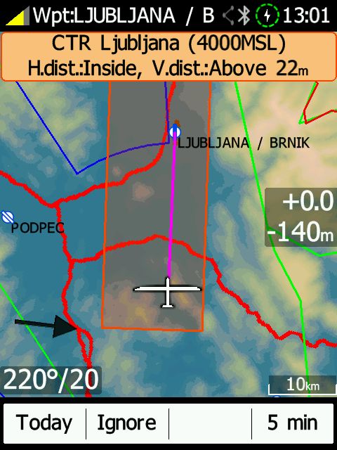
Added Airspace Warnings
-
Task export / load /edit
-
Added Thermal Assistant
-
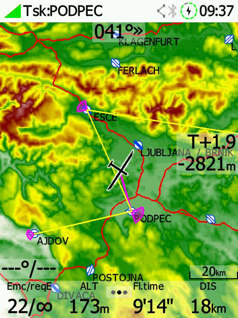
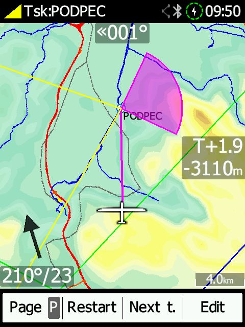
Added glider path
-
Multiple .CUP files support
-
Flarm symbols improved
-
Wind editing on the screen
-
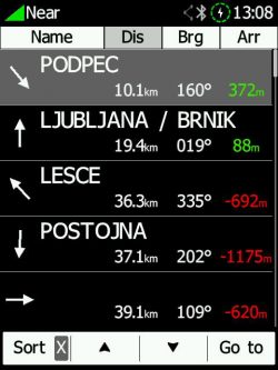
Nearest list – improved by icons, arrival altitude added
-
Improved airspace display
-
Minor bug fixes
Various Improvements
NAVBOXes
A lot of new Navboxes. Now you can choose up to 12 navboxes per each page.
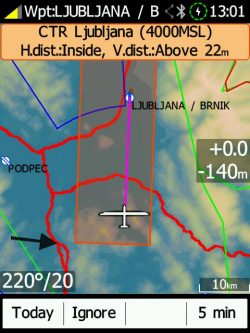
AIRSPACE Warnings
Airspace warnings with 3 options: cancel for TODAY or 5 minutes or IGNORE them.
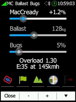
MAP shortcuts
Simply click on the MacCready widget and enable/disable following options: Airspace, Waypoints, Map, Terrain and Vario tape.