Version 7
Get Connected!
Version 7.0 is bringing enhanced connectivity, more supported services, 3rd party devices and many new features. We improved the graphics on the V8/V80 varios as well, where you can now have a new NON-LINEAR scale, different needle styles and updated graphics with clearer readings. There are also some user friendly improvements (new MC/BALL/BUGS dialog) and minor bug fixes. Upgrade for free.
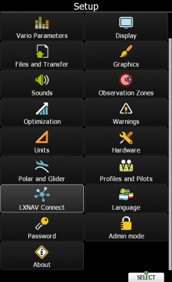

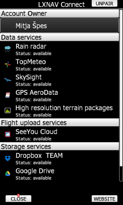
LXNAV CONNECT
We developed our own cloud called LXNAV Connect where you get all weather services, storage services and automatic updates from LXNAV server and SoaringSpot. Supported weather services are: TopMeteo, SkySight, Rain Radar and Satellite pictures! There are also other services like US Sectional Charts, High resolution terrain maps, GPS Aero data, SeeYou Cloud, SoaringSpot integration, Dropbox and Google Drive. You can also switch on automatic profile syncing from your device with your LXNAV Connect storage.
Profile sync
Profile sync will allow you to have one single profile synced across various applications. You can edit your profile on LXStyler and when you turn on the LX80/90xx device, it will be automatically synced with your latest profile saved on your LXNAV Connect storage service.
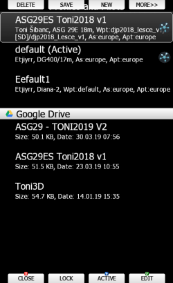
Loaded profiles from LXNAV Connect
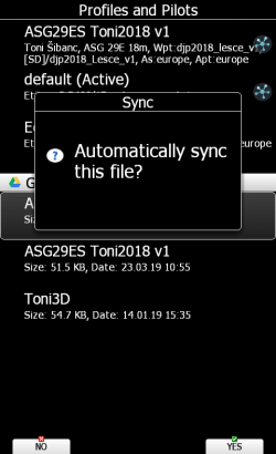
Dialog asking for sync
Flight uploading
Flight log can be uploaded to your email, Google Drive, DropBox and SeeYou Cloud. Automatic upload to OLC is supported as well, so you can claim your flight immediately after landing!
OLC claim
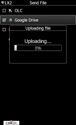
Upload to Google Drive
Maps
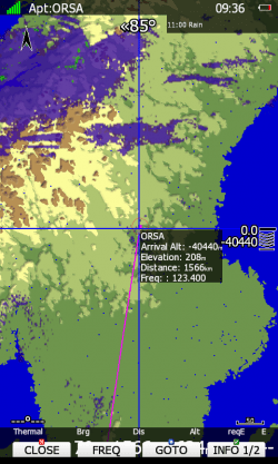
US Sectional charts and High resolution terrain files are available for free in our LXNAV Connect service. Maps are download directly to device through Wi-Fi, so no more SD cards or USB keys!
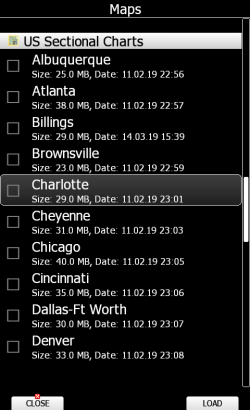
US Sectional Charts
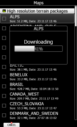
High resolution terrain
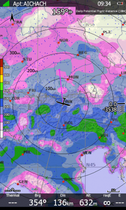
Weather services
We support various Weather services. Supported services are RainRadar, TopMeteo and SkySight. TopMeteo and SkySight support weather services with Satellite images as well. We support live weather and prediction weather for defined amount of time!
TopMeteo
RainRadar
SkySight
GPS Aero data
GPS AeroData is a database that contains airspace, NOTAMs, and customized information.
GPS Aero Data
Additional PowerFLARM features
It is now possible to update PowerFLARM external devices and set many configuration settings to PowerFLARM over the main LXNAV device.
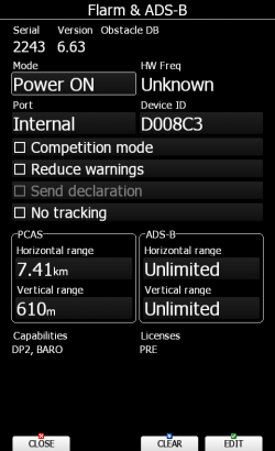
PowerFLARM Configuration
Vario settings
We added a new non-linear vario scale and possibility to change the vario needle style. Everything can be edited through main LXNAV device.
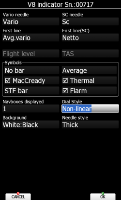
V8x configuration screen
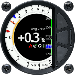
Non-linear scale with Thin needle
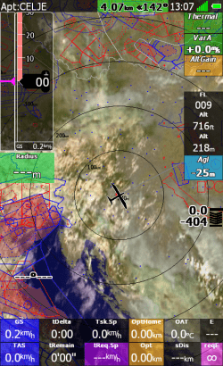
Map settings per page
Map settings can be configured by specific page now. You can customize every page separately according to your needs.
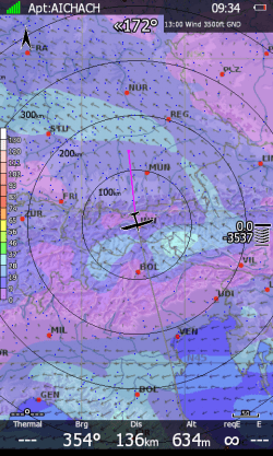
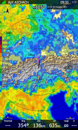
APT page 1 ->Satellite picture
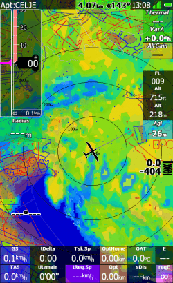
APT page 2 -> SkySight
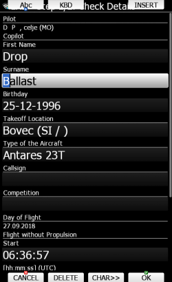
Improved graphics dialog MacCready/Ballast/Bugs
We changed the look of MacCready/Bugs/Ballast dialog to fit the users’ needs. User experience is now fresher and clearer so you can grasp information faster.
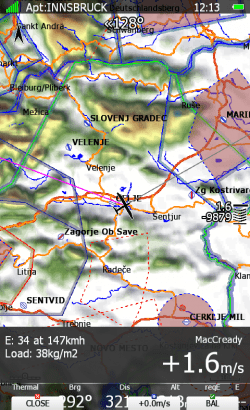
MacCready
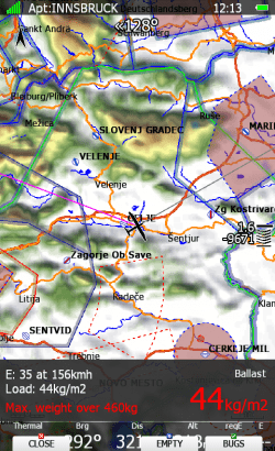
Ballast
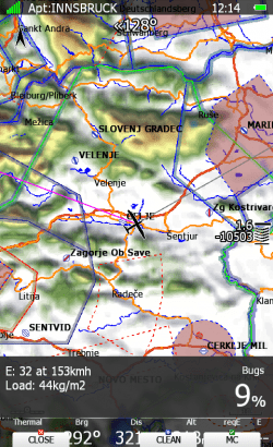
Bugs
Various Improvements
-
AirAvionics display supported
-
Added revolution time navbox
-
Possibility to download PDFs
-
Added hPa unit
-
Added gate interval task option
-
Added support for internal ADS-B module (coupled with PowerFlarm)
-
Added A/C traffic setting to Flarm warnings dialog
-
Added SWAP button in flight recorder settings for easier swapping of pilot and copilot names