Version 6
Go Online!
Version 6.0 is fully dedicated to Wi-fi connectivity, such as Weather integration, Task uploads/downloads and no more usage of SD/USB key for any kind of updates. Another important feature is supporting connectivity with 3rd parties, such as radios and transponders. For competition purposes we have done a lot of algorithm calculation improvements and most importantly, the AAT assistant with Isospeedlines based on complex calculating methods. The new version also has a small surprise for pilots. Terrain, Maps and airspaces are improved and more detailed and as usual, you can download them for FREE. There are also some user friendly improvements and minor bug fixes. Upgrade for free at firmware-request menu option.
More Detailed Maps and Terrain
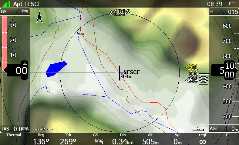
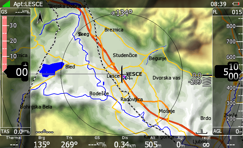
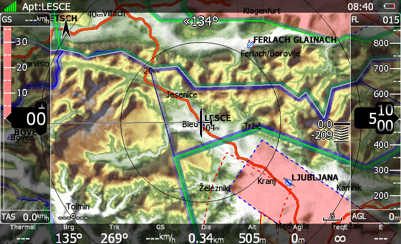
Maps and Terrain are now improved and more detailed. There are some new, added elements so you will know your flight surrounding even better. New added elements like: glaciers, forests, fields, grass fields, streams, streets, railroads, airport runways etc. Updates are completely FREE of charge (new maps are preloaded since January 2013 – for older devices please contact us). For example check image below:
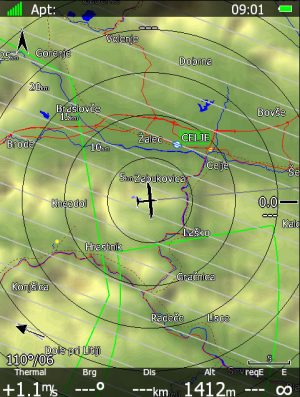
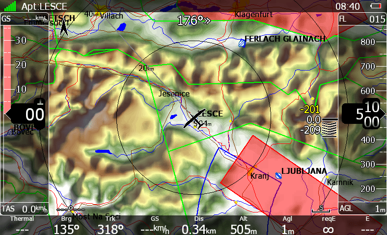
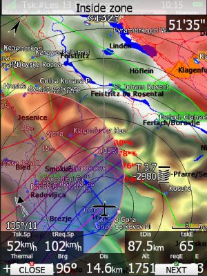
More Detailed Airspaces
Let’s connect!
-
Download the latest competition tasks from SoaringSpot
-
Upload flights to SeeYou Cloud
-
Upload flights directly to OLC
-
Send flights to your email
-
Update LX systems through the Wi-Fi (no more SD card or USB key, no more Update key needed)
-
Update databases (airspace/airports) through the Wi-Fi
-
Rain radar animation picture on the map during flight
-
Download APT meteograms
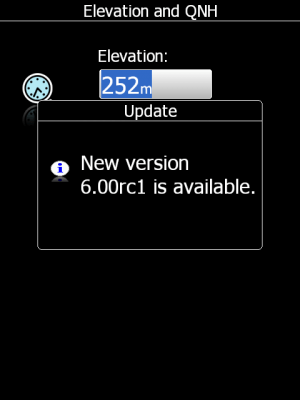
Update Message
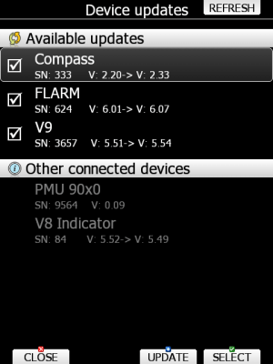
Device Updates
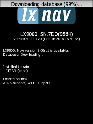
Downloading Database
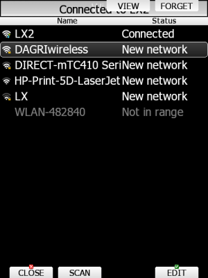
Wi-Fi Networks List
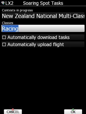
Soaring Spot
Weather
Supported 3rd party Radio and Transponder connectivity
-
Supported all main 8.33 kHz radios (Trig, Becker, KRT2, Funke)
-
Supported all main transponders (Becker BXP6402, Funkwerk TRT800, Trig TT21/22, KTX)
-
Set frequency on the LX which is sent to your radio/transpodner
-
Automatically passive frequency set after select of a NEAR apt
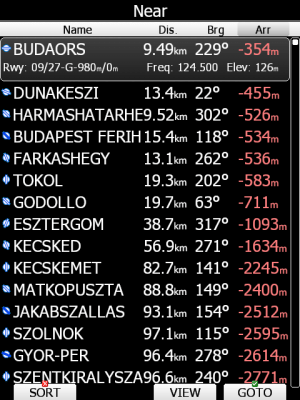
Near List
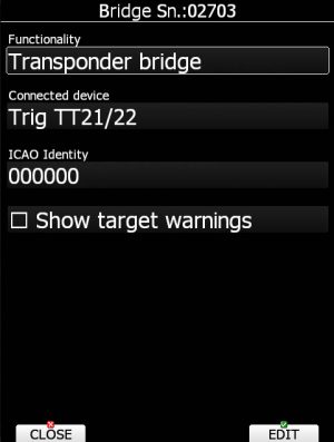
XPDR Bridge
AAT assistant tools
Added AAT isolines and fill based on Expected Distance, Expected speed, Delta time.
AAT Lines
XPDR Bridge
Various Improvements
-
Added speed to fly symbol to speed tape
-
Added overspeed VNE based on TAS
-
Added many new polars: ASG 32, DG1001 M, Apis BEE, LS6, Piccolo B, ASH 30MI
-
Improved warning system for the Gear and Waypoint
-
New more precised Terrain version 2
-
Added more detailed height data
-
Improved night option, dims backlight to level, that is comfortable for the pilot in the night.
-
PCAS warning shows also altitude
-
Flarm: no tracking mode added
-
Flarm view – new graphic interface (split screen of list selection and map selection)
-
SC buttom on remote has same programmable function as FN button
-
New programmable functions for FN and SC button on remote stick: toggle vario range, toggle map setting, select,MC/BAL, map, wind, airspace, mark, flarm, pan,event, rot.fai, team
-
3d screen improvement
-
METAR TAF improvements
-
Improved airspace display
-
Minor bug fixes
Various Improvements